Forest Images photographed by ESA’s Biomass satellite
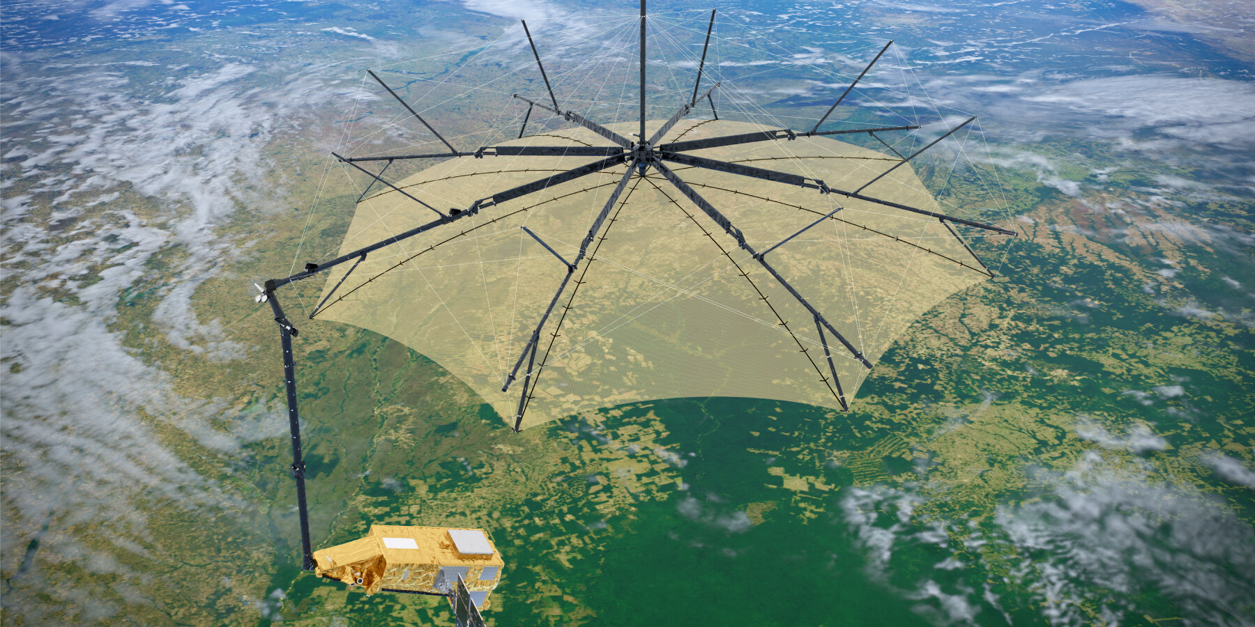
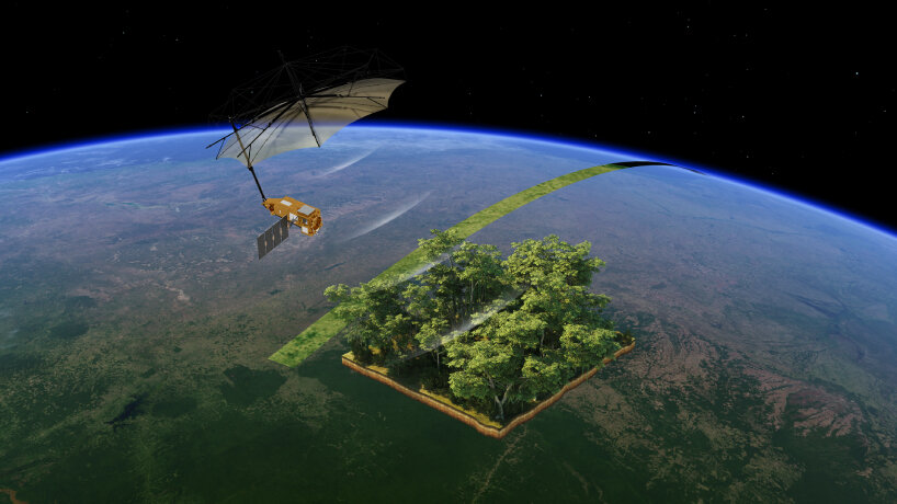
The umbrella-shaped Biomass satellite of the European Space Agency (ESA) photographs the first aerial images of the Earth’s forests and topography. The spacecraft, which is being used to study forests from space, comes with equipment called P-band synthetic aperture radar, a tool that can see through the canopy of the trees and measure the woody parts of the forests, from the tree trunks to the branches and stems. The images are an important breakthrough for the space agency because these can allow scientists to understand and analyze how much carbon is stored in the forest, which is a key to monitoring climate change.
ESA revealed the images at the Living Planet Symposium on June 23rd, 2025, adding that the photos are ‘a major leap forward in our ability to understand how Earth’s forests are changing and exactly how they contribute to the global carbon cycle.’ At the present time, ESA’s Biomass satellite has just been launched and is gearing up for its full operation. The engineers are calibrating its systems and instruments, including the radar, so that the umbrella-shaped spacecraft can collect data accurately, send them to the team on Earth, and have them studied by the scientists. Currently, the data isn’t accurate enough yet to be used for full scientific studies.
all images courtesy of The European Space Agency (ESA)
Installed radar captures what’s under landscape surfaces
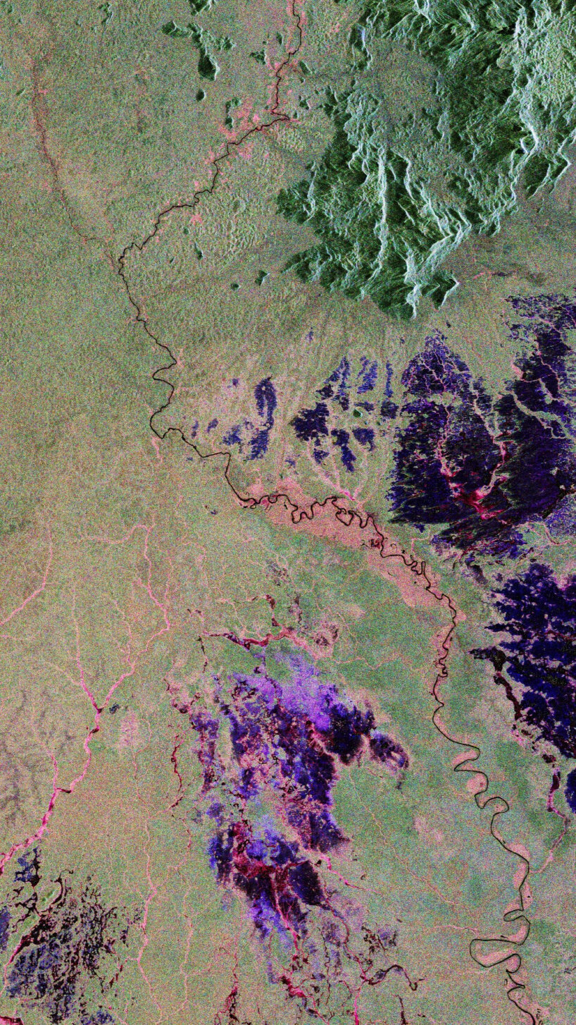
The first image captured by ESA’s Biomass satellite is the forest of Bolivia, which has experienced deforestation in the past to make room for farms and agriculture, ranking among the highest globally for primary forest loss. The photo has two parts: the one above with green landscapes is captured by Copernicus Sentinel-2, while the one below it is by Biomass. This one shows different colors: green for the rainforest, red for the wetlands, blue or purple for the grasslands, and black for the rivers and lakes. Here, the spacecraft image even displays the Beni River, still flowing naturally and meandering across the land. The first image also demonstrates the capability of ESA’s Biomass satellite, which can frequently scan the same area and use its radar to measure tree height and biomass.
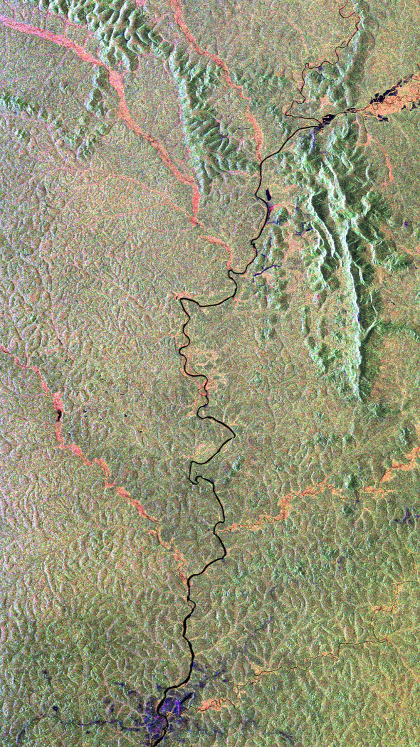
The next image shows the Amazon rainforest in northern Brazil. The pink and red in the southern part are the wetlands, the red along the rivers is the forested floodplains, and the green in the north is the forest. The ESA Biomass satellite here is able to capture the image and detect nature under dense vegetation, like wetland features, because radar waves penetrate the forest canopy. The other photos include the Halmahera rainforest in Indonesia, where the researchers can clearly see the active volcano Mount Gamkonora, as well as the rainforest in Gabon, Africa, where the Ivindo River and the dense forest cover stand out.
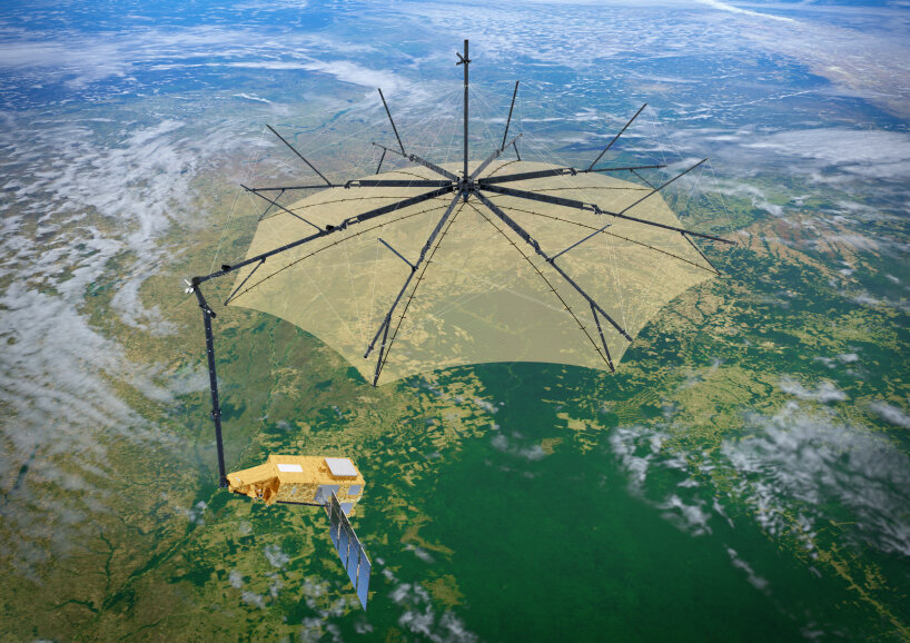
Biomass with its 12-m diameter radar antenna
The satellite can also photography deserts
The ESA’s Biomass satellite images also showcase the deserts, including the recently captured section of the Sahara Desert in Chad, with part of the Tibesti Mountains. The installed radar is able to penetrate dry sand up to five meters deep, allowing scientists to detect hidden features like ancient riverbeds and dried-up lakes buried under the desert surface. Then, there’s also an image of Antarctica, specifically a portion of the Transantarctic Mountains and the Nimrod Glacier, which flows into the Ross Ice Shelf.
Because of its long radar wavelength, Biomass can look deep into the ice, which other satellites with shorter wavelengths aren’t able to do at the present time. The P-band synthetic aperture radar helps the ESA’s Biomass satellite dive through the thick forest canopy to photograph and analyze the landforms under it. Unlike the other satellites, like the Copernicus Sentinel-2, this spacecraft uncovers the terrain and exposes the underlying landscapes. It is important for the scientists to understand the carbon storage of these forests as well as to help them learn how the climate in a specific region has changed over time.
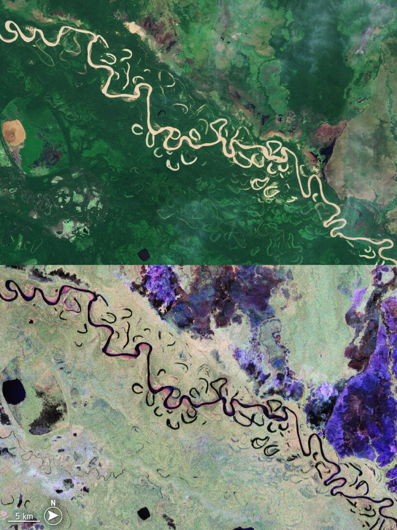
above: Bolivia captured by Copernicus Sentinel-2; below: the same area photography by Biomass
Biomass sees through the Amazon rainforest in northern Brazil
topography of Gabon in Africa with the Ivindo River (in black) appearing visible
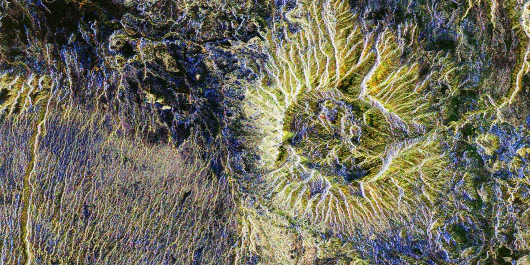
captured structure of the Sahara Desert in Chad


happening now! SICIS brings the intricate art of mosaic and innovative materials to interior design, harmonizing every element — from furniture to surfaces — for complete environments.
climate change (184)
 Jul 09, 2025
 Jul 02, 2025
 Jun 24, 2025
 Jun 21, 2025
 Jun 15, 2025
space travel design (110)
 Jun 26, 2025
 Jun 26, 2025
 Jun 20, 2025
 Jun 12, 2025
 May 26, 2025
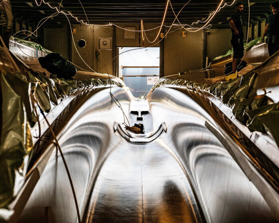 Jun 30, 2025
 Jun 17, 2025
 May 21, 2025